

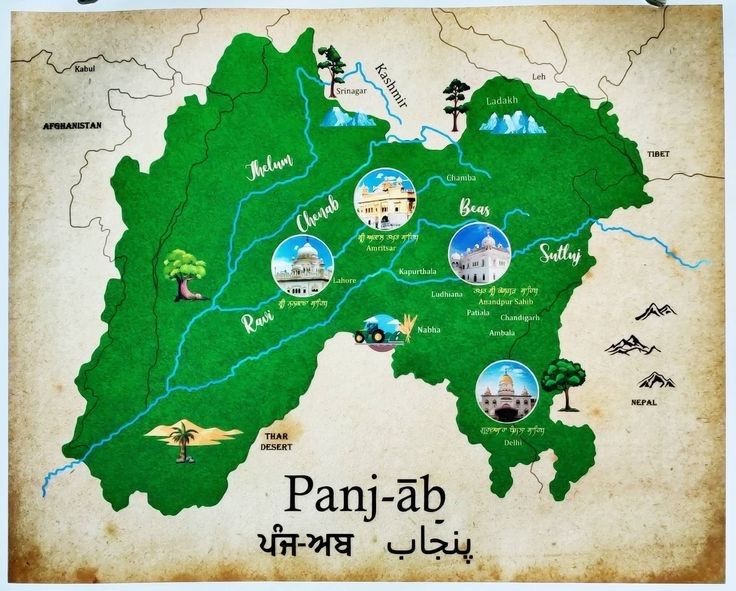
ਸੰਗਰੂਰ – ਨਕਸ਼ਾ ਅਤੇ ਇਤਿਹਾਸਕ ਖੇਤਰ Sangrur – Map and Historical Regions
ਸੰਗਰੂਰ ਦੀ ਇਤਿਹਾਸਕ ਹੱਦਬੰਦੀ ਵਕਤ ਦੇ ਨਾਲ ਬਦਲਦੀ ਰਹੀ। ਇਹ ਇਲਾਕਾ ਜੀਂਦ ਰਿਆਸਤ (Jind State) ਦਾ ਮਹੱਤਵਪੂਰਨ ਹਿੱਸਾ ਸੀ, ਜੋ 18ਵੀਂ ਅਤੇ 19ਵੀਂ ਸਦੀ ਦੌਰਾਨ ਇੱਕ ਵੱਡੀ ਸਿੱਖ ਰਿਆਸਤ ਵਜੋਂ ਉਭਰੀ। ਆਓ ਵੇਖੀਏ ਕਿ ਸੰਗਰੂਰ ਕਿਹੜੀਆਂ ਹੱਦਾਂ ਵਿੱਚ ਸੀ ਅਤੇ ਕਿਹੜੀਆਂ ਤਾਕਤਾਂ ਨੇ ਇਸ ‘ਤੇ ਕਬਜ਼ਾ ਕੀਤਾ|
The historical boundaries of Sangrur changed over time. This region was a significant part of the Jind State, which emerged as a prominent Sikh kingdom in the 18th and 19th centuries. Let’s look at the historical boundaries of Sangrur and the powers that controlled it.

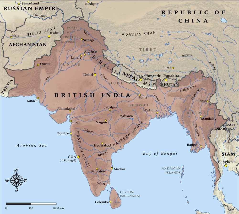
1. ਮੁਗਲ ਦੌਰ (1526-1707)
• ਮੁਗਲ ਸਮਰਾਟ ਅਕਬਰ (1556-1605) ਨੇ ਪੰਜਾਬ ਦੇ ਕਈ ਇਲਾਕਿਆਂ ਨੂੰ ਆਪਣੇ ਸੂਬਿਆਂ ਵਿੱਚ ਵੰਡਿਆ।
• ਸੰਗਰੂਰ ਮੁਗਲ ਪੰਜਾਬ ਦਾ ਹਿੱਸਾ ਸੀ ਅਤੇ ਸਿੱਧਾ ਦਿੱਲੀ ਦਰਬਾਰ ਤੋਂ ਪ੍ਰਬੰਧਤ ਹੁੰਦਾ ਸੀ।
• ਇਸ ਦੌਰ ਵਿੱਚ ਮੁਗਲ ਟਕਸਾਲਾਂ ਵਲੋਂ ਬਣੇ ਹੋਏ ਨਕਸ਼ੇ ਹੁੰਦੇ ਸਨ, ਜੋ ਆਮ ਤੌਰ ‘ਤੇ ਜਿਲ੍ਹਿਆਂ ਅਤੇ ਪ੍ਰਾਂਤਾਂ ਵਿੱਚ ਵੰਡੇ ਜਾਂਦੇ।
1. Mughal Era (1526-1707)
• Mughal Emperor Akbar (1556-1605) divided many regions of Punjab into provinces under his control.
• Sangrur was part of Mughal Punjab and was directly governed from the Delhi Darbar.
• During this period, maps created by Mughal mints were distributed, typically showing the districts and regions governed
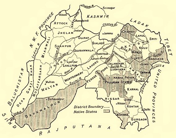
2. ਸਿੱਖ ਰਾਜ ਅਤੇ ਜੀਂਦ ਰਿਆਸਤ (1763-1947)
• 1763: ਮਹਾਰਾਜਾ ਗਜਪਤ ਸਿੰਘ ਨੇ ਜੀਂਦ ਰਿਆਸਤ ਦੀ ਸਥਾਪਨਾ ਕੀਤੀ ਅਤੇ ਸੰਗਰੂਰ 1775 ਵਿੱਚ ਇਸ ਰਿਆਸਤ ਦੀ ਰਾਜਧਾਨੀ ਬਣੀ।

ਜੀਂਦ ਰਿਆਸਤ ਦੀ ਸਰਹੱਦਾਂ ਵਿੱਚ ਸ਼ਾਮਲ ਸੀ:
• ਉੱਤਰ – ਲੁਧਿਆਣਾ, ਪਟਿਆਲਾ
• ਦੱਖਣ – ਹਿਸਾਰ, ਰੋਹਤਕ
• ਪੂਰਬ – ਕਰਨਾਲ, ਕੈਥਲ
• ਪੱਛਮ – ਭੱਟੀਆਂਣਾ (ਹੁਣ ਦਾ ਹਨੂੰਮਾਨਗੜ੍ਹ, ਰਾਜਸਥਾਨ)
• ਜਿੰਦ ਰਿਆਸਤ ਵਿੱਚ ਸੰਗਰੂਰ, ਜੀਂਦ, ਨਰਵਾਣਾ, ਦਿਜੀ, ਭਵਾਨੀगढ़ ਆਦਿ ਸ਼ਹਿਰ ਸ਼ਾਮਲ ਸਨ।
• 1801 ਤੋਂ 1839 ਤੱਕ, ਮਹਾਰਾਜਾ ਰਣਜੀਤ ਸਿੰਘ ਦੀ ਸ਼ਕਤੀ ਨਾਲ, ਇਹ ਇਲਾਕਾ ਸਿੱਖ ਅਧੀਨ ਰਿਹਾ।
• 19ਵੀਂ ਸਦੀ ਦੇ ਨਕਸ਼ਿਆਂ ਵਿੱਚ ਜੀਂਦ ਰਿਆਸਤ ਨੂੰ ਇੱਕ ਅਲੱਗ ਸਿੱਖ ਰਿਆਸਤ ਵਜੋਂ ਦਰਸਾਇਆ ਜਾਂਦਾ ਹੈ।
Sikh Raj and Jind State (1763-1947)
• 1763: Maharaja Gajpat Singh established the Jind State, and Sangrur became the capital of Jind State in 1775.
• The boundaries of Jind State included:
• North – Ludhiana, Patiala
• South – Hisar, Rohtak
• East – Karnal, Kaithal
• West – Bhattianna (now Hanumangarh, Rajasthan)
• Sangrur, Jind, Narwana, Diji, and Bhavanigarh were among the key cities of Jind State.
• From 1801 to 1839, the region was under Sikh rule, especially the control of Maharaja Ranjit Singh.
• Maps from the 19th century depict Jind State as a distinct Sikh territory.
3. ਬ੍ਰਿਟਿਸ਼ ਦੌਰ (1849-1947)
• 1849 ਵਿੱਚ, ਬ੍ਰਿਟਿਸ਼ ਨੇ ਪੰਜਾਬ ਜਿੱਤ ਲਿਆ ਅਤੇ ਸਿੱਖ ਰਿਆਸਤਾਂ ਨੂੰ ਪਰੋਟੈਕਟੋਰੇਟ (ਸਰੰਖਸ਼ਿਤ ਰਿਆਸਤਾਂ) ਵਜੋਂ ਰੱਖਿਆ।
• ਜਿੰਦ ਰਿਆਸਤ ਨੇ ਬ੍ਰਿਟਿਸ਼ ਸਨਰੱਖਣ ਵਿਚ ਰਹਿੰਦੇ ਹੋਏ ਆਪਣੀ ਆਤਮ ਨਿਰਭਰਤਾ ਕਾਇਮ ਰੱਖੀ।
• ਬ੍ਰਿਟਿਸ਼ ਨੇ 1860 ਦੇ ਨਕਸ਼ਿਆਂ ਵਿੱਚ ਜਿੰਦ ਰਿਆਸਤ ਨੂੰ ਪਟਿਆਲਾ ਅਤੇ ਨਾਬ੍ਹਾ ਦੇ ਨਾਲ ‘ਫੁਲਕੀਆਂ ਰਿਆਸਤ’ (Phulkian States) ਵਜੋਂ ਦਰਸਾਇਆ।
• ਬ੍ਰਿਟਿਸ਼ ਨੇ 1946-47 ਵਿੱਚ ਨਵੇਂ ਹੱਦਬੰਦੀ ਨਕਸ਼ੇ ਤਿਆਰ ਕੀਤੇ,

3. British Era (1849-1947)
• In 1849, the British took control of Punjab and made the Sikh states protectorates (protected states).
• Jind State maintained its autonomy while under British protection.
• In 1860, British maps depicted Jind State along with Patiala and Nabha as the Phulkian States.
• In 1946-47, the British produced new boundary maps to reflect the partition and changes leading up to Indian independence.
